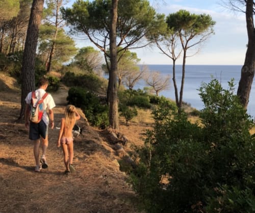
Hikes we enjoy
Galenzana
la via dei rosmarini
On this trail you’ll submerge yourself in the fragrances of Elba like rosemary, broom and lavender and at the same time surrounded by great landscapes.
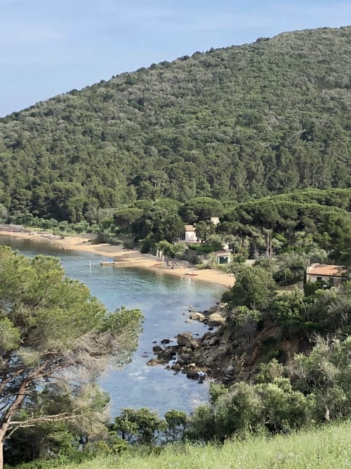
The Rosemaries trail goes along the coast for about 10kms, departing from the beach of Marino di Campo near la Foce to Fonza Beach and other small bays.
The best time to hike it’s February, when rosemary is blooming.
Punta di fetovaia
At the height of the Hotel Galli we turn left into the road leading up to the promontory. We pass among Fetovaia Hotel respectively between Hotel Anna and the Hotel Montemerlo and reach the dirt road, which leads us to the path that climbs into the Mediterranean zone towards Punta Fetovaia. After about 250 m the trail leads on the track that runs into the crest of the hill and we can see on the right the road that connects Fetovaia to Pomonte.
We put on the dirt road, ignoring the many paths that branch off from it, and go back. A little further on, the view will open on the open sea and the track will shrink and will unfold in the bushes overlooking the sea. You remember to pay close attention and do not get too close to the high cliff, because the ground may be crumbling. This is also a panoramic point where you can admire the islands of Pianosa and Montecristo, and then we come to a pitch where it appears, to our left, the cove of Fetovaia in all its beauty.a
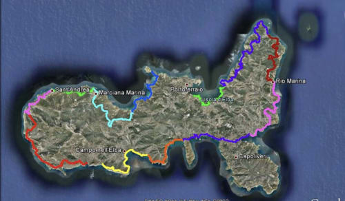
La via delle essenze
"La Via dell'Essenza" is a project aiming to create a coastal trail on Elba Island. 130 kilometres of trails divided into 12 sections intended to show Elba and its unique essence to the whole world.
Acqua dell’Elba supports this project with the aim of enhancing the natural beauty of the Island. Furthermore, the project seeks to promote access for residents and tourists, while fully respecting nature, as well as for those who cannot visit Elba in person, thanks to digital technologies.
The coastal trail is open to hikers and amateurs, families, children and school groups. The variety and richness of the trails make it possible to attract hiking tourism all year round and also to enrich the experiences available to summer tourists.
Acqua dell'Elba's support to this project includes the routine maintenance of the selected paths, the restoration of the walking surface, the vegetation upkeep alongside the trails, as well as the identification and enhancement of historical and naturalistic highlights. For this reason, the "La Via dell'Essenza" project reflects the deepest values of Acqua dell'Elba: a commitment based on the belief that improving the life of every human being requires careful care and protection of the environmental heritage.
Here are the 12 legs of the trail:
“La Via della Lavanda” The January trail. Mortigliano – Cavoli
Length: 15.8 km; Maximum altitude: 583 m; Uphill gradient: 1,140 m; Downhill gradient: 1,272 m.
“La Via dei Rosmarini” The February trail. Colle Palombaia – Fonza
Length: 9.75 km; Maximum altitude: 157 m.
“La Via dei Ginepri” The march trail. Fonza – Lacona
Length: 7.30 km; Maximum altitude: 162 m.
“La Via delle Ginestre” The April trail. Lacona - Porto Azzurro
Length: 9.86 km; Maximum altitude: 70 m.
“La Via dei Cisti” The May trail. Porto Azzurro - Rio Marina
Length: 13.4 km; Maximum altitude: 212 m.
“La Via dei Corbezzoli” The June trail. Rio Marina – Cavo
Length: 13.6 km; Maximum altitude: 204 m.
“La Via dell’Elicriso The July trail. Cavo – Bagnaia
Length: 18.5 km; Maximum altitude: 323 m.
“La Via delle Tamerici” The August trail. Bagnaia - San Giovanni
Length: 6.58 km; Maximum altitude: 54 m.
“La Via dei Lecci” The September trail. Enfola – Procchio
Length: 9.33 km; Maximum altitude: 78 m.
“La Via del Mirto” the October trail. Procchio - Marciana Marina
Length: 9.6 km; Maximum altitude: 236 m.
“La Via dei Lentischi” The November trail. Marciana Marina - S.Andrea
Length: 6.68 km; Maximum altitude: 197 m.
“La Via dell’Erica” The December trail. S.Andrea – Mortigliano
Length: 7.12 km; Maximum altitude: 142 m.